Teacher Edition | View the Map
Week of September 29, 2024
Right click and SAVE AS
to download the Google Earth file for this episode
Use free Google Earth software
to OPEN it, using File> Open.
Find more tech info here.
Monday
Today was another amazing Uncle GT day! Geo and I got a letter from our Uncle Globetracker (we call him Uncle GT) in Washington, D.C. He always gives us such interesting gifts. But today's topped all of our expectations. Geo and I are being sent on a top-secret mission - and our first stop is NEW YORK CITY!! Our missions for Uncle GT are the most exciting trips ever!
We leave Phoenix first thing tomorrow morning. I sure hope it is cooler in New York. Today it was so hot out - over 100 degrees - Fahrenheit, a bit warmer than our typical fall weather. It was too unbearable even to go outside. Here is the note we received with our airline tickets:
Dear Geo and Meri,
How are my favorite niece and nephew? Your Uncle Globetracker has a new assignment for you two. If you are interested, I need you to report to New York City tomorrow morning. Your instructions will be waiting for you in the observatory (on the 86th floor) at the Empire State Building. Look for the purple folder. You will have an excellent city view at 1050 feet above the ground.
Please do not tell anyone about this mission (especially little Pandora - we know how hard it is for her to keep a secret). Don't worry; I have already talked to your high school and parents. The school has given you permission to study under my supervision for a while, especially since you are so far ahead with your work. However, the school requires you to keep a detailed journal of the journey. The journal must include pictures from the places that you visit. So start keeping accurate records immediately.
You will be under my care and protection throughout this journey. They are all aware that you may be gone for a week, month, or even longer. The government really needs your help. Get ready for a unique adventure. I have included a map to see the distance you will be traveling. More information will be in the purple folder.
Love,
Uncle GT
Holy Idaho! I can't wait to find out about this new adventure. I hope I can get some sleep tonight. Geo and I sat down and looked at the political map Uncle GT sent us that shows the states and major cities in North America. There are maps for all sorts of things - the climate, natural resources, physical maps showing mountains, rivers, lakes, and many other types of maps. Take a look at the map I linked below.
Geo and I finally found Phoenix and New York City on the map. Can you find the cities?
Geo and I first wanted to figure out the cardinal direction we would be traveling in. When we look at the cities on the map, New York is above Phoenix. So we are heading upwards on the map--which means we are heading to the northern part of America because the top of the map usually represents the north. This map does not seem to show a compass rose to indicate where north is, so we will assume it is up.
But we are also heading to the right. If up is north, you are traveling east, heading to the right. So that means that New York City is northeast of Phoenix.
Geo and I also wanted to figure out how far Phoenix is from New York City. Luckily, the map Uncle GT sent us also provides a map scale to measure the distance. The map scale shows the amount of map distance that represents 500 miles. Geo and I estimated that New York City is between 2,000 and 2,500 miles from Phoenix. Holy Idaho! That must be the farthest that we have traveled yet on any mission. I am glad that we are flying and not driving. We would have to drive for a few days to travel that many miles.
New York City is located near the Atlantic Ocean. I am so excited because we have only ever seen the Pacific Ocean. Although the Atlantic Ocean is smaller than the Pacific, I still can't wait to see the waves!
Now we just have to ensure our annoying little sister, Pandora, doesn't find out! Pandora is 5 years younger than we are and always causes trouble for us. One time she secretly followed us on a mission for Uncle GT. Of course, it was our fault (according to my parents) for allowing Pandora to read our journal. If she finds out we are heading to New York City, who knows what she might do to mess up this mission? We need your advice at the end of this post on how to trick her!
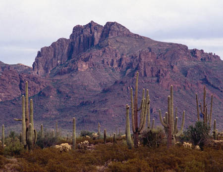
By the way, I read today that Phoenix is the fifth-largest city in the USA. I have lived here for over 16 years and didn't know we lived in such a popular area. Holy Idaho! Geo just told me something else about Phoenix. Did you know that we live in the most populated state capital in the entire United States? Wow, we must have a ton of people living in Phoenix! I have pasted some pictures of our home state (Arizona) into this journal.
- Meri

The beautiful Arizona Desert

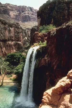
Here is a picture of a cascading waterfall at the Grand Canyon National Park - one of my favorites.
Map of the United States
Which way is north on this map? (Hint: there is no compass rose showing, so what is the assumed direction for north?)
Can you find Phoenix and New York City on the map? Use your finger to trace the path in the air from Phoenix to New York. What cardinal direction is your finger moving?
Can you find the scale on this map?
cardinal direction - a term used to describe all four primary directions (north, south, east and west).
map scale - a graphic or line that shows the relationship between the distance on a map and the corresponding distance on the earth. For example, 1 inch may equal 500 miles. This allows users to calculate the approximate distance between two locations on a map.
Back to topAdditional Web Resources:
All about the Empire State Building
Grade 3-5: Knows the basic elements of maps and globes (title, legend, cardinal, scale, grid, meridians, time zones, etc.).
Grade 3-5: Knows major physical and human features of places as they are represented on maps and globes. Knows how to read different maps: road, relief, globe, etc..
Grade 3-5: Knows the location of major cities in North America.
Grade 6-8: Knows the relative location of, size of, and distances between places.
Grade 3-5: Knows different methods to measure data (miles, kilometers, time, etc..).