Teacher Edition | View the Map
Week of December 8, 2024
Right click and SAVE AS
to download the Google Earth file for this episode
Use free Google Earth software
to OPEN it, using File> Open.
Find more tech info here.
Hey Geo and Meri,
I am not surprised that "Equator" was a fictitious name. I am not sure "Herring" is their real name either. We have been investigating this couple for a while. They are co-owners of Royalian Hotels International (based in northern Canada). It turns out that they are using Dewey to obtain information about the opening up of more of the Northwest Passage for their company.
The Northwest Passage is what explorers have always hoped to find: a shortcut between the Atlantic and Pacific Oceans through the Canadian Arctic. This passage is a direct route for ships to travel from Europe to Asia across the Arctic Ocean. The passage is becoming ice-free for the first time since satellite records began to be kept in the 1970s. In fact, in 2024, small ships can get through now! Scientists thought that this passage would begin to clear (from the Arctic sea ice melting) around 2030 or later. But it began to clear in September 2007. In fact, in September 2016, even a (small) cruise ship was finally able to pass through this route. Even small ships can only get through the passage during the warmer summer months. That would be one beautiful trip. I posted an article about the adventure below.
The "Equators/Herrings" are using Dewey to discover the truth about the Northwest Passage (will it remain ice-free?). Europe, the United States, Canada, and even Russia have tried to lay claim to the passage and surrounding areas in the hopes of securing some of the oil and other minerals that may be found. Everyone wants a piece of the Northwest Passage because it offers new natural resources and money for those who control it. Based on our research, it seems that Canada would be the owner of this passage since the water is on Canadian territory.
You see, the earth doesn't usually have any "new" landforms or bodies of water. So the Northwest Passage is of immense importance to many individuals worldwide. It will be interesting to see what happens with it in the future. For now, it seems that the "Equators/Herrings" want to make money from the Northwest Passage one way or another. I wonder if that is why they were in Canada last month. Only time will tell. Have a safe trip to Africa. I will be in touch if I find out any more information about the Northwest Passage or the "Herrings/Equators".
Love,
Uncle GT
- Geo
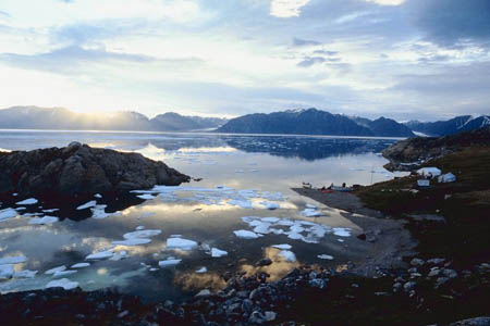
The Northwest Passage
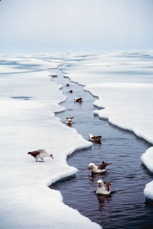
Check out these ducks swimming in the Northwest Passage (during the cooler months of the year)!
Northwest Passage
Here is a website that Uncle GT sent about the Northwest Passage.
History of the Northwest Passage
Here is another article from Uncle GT.
All aboard: Cruise through the once-impassable Northwest Passage
Here is the link from Uncle GT about the cruise ship. So cool!
Holy Idaho! Africa is one amazing continent. I don't even know where to begin. Africa is second in both overall size and population (among the other continents). I wonder which continent is the largest in size and which one is the most populated. So far, we have been to North America and South America. I know neither of those continents were ranked first in overall size or population.
There are a lot of animals in Africa, but there is so much more. Did you know that the world's largest desert is in Africa? The Sahara desert stretches across northern Africa. Geo just told me that the word "Sahara" means desert in Arabic. Some of the animals found in the Sahara desert include birds, snakes, gerbils, and other animals. The Sahara desert runs through 11 countries in Africa. Holy Idaho! That is one huge desert. The Atacama Desert in Chile must be much smaller than the Sahara desert. I heard the lady behind me mention the term "Sub-Saharan Africa". I wonder what that means? It must have something to do with the Sahara desert.
We are getting ready to fly over the country called Congo. In Congo, you will find the Congo River and Congo Rainforest. This rainforest is the 2nd largest in the world. Do you remember which rainforest was the largest? You are correct if you guessed the Amazon Rainforest (in South America)!
Africa (like South America) is located in both the southern hemisphere and northern hemisphere. The equator runs through the middle of the continent. You will find the Congo Rainforest running right along the equator. Oh no, we are hitting turbulence, and I must put away all electronic devices. I will post more after we land.
- Meri
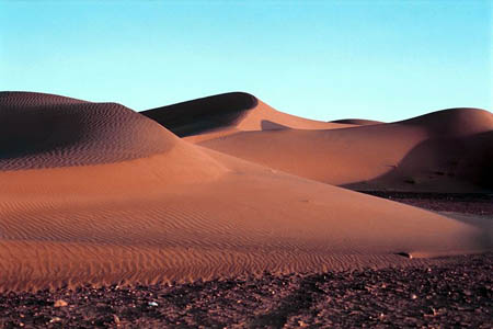
The beautiful Sahara Desert
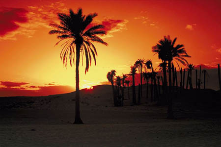
Sunset in the Saraha Desert
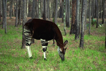
The Okapi - an endangered animal from the Congo Rainforest
Africa map
Click on any country to learn more information and to see some cool photos.
Text Message from unknown number - I C U - Do U C Me?
Once we returned to our seats because of the rough air, I decided I better tell Meri. We thought that the Equators/Herrings must be on this flight. We knew what Claude looked like because we saw his driver's license in Canada several weeks ago. He has reddish/blond short hair. He is a tall man. He looks a little taller than I am. So, he must be about 6'2" or so. But we had no idea what Phoebe looks like.
Once we were through the rough patch in the sky and allowed to get up and move around, Meri and I split up. Meri started at the front of the airplane, and I started at the tail. We looked for men who matched the description of Claude. We found 3 men who could have been Claude. One of the men was traveling alone, so we knew that he wasn't Claude. We couldn't decide which of the other two men was Claude, so we tried to overhear what they were talking about with the women sitting next to them. The one man kept talking about ships, and the other man (we think) was talking about some village in Ethiopia. We decided to follow the one talking about ships. Since we had learned about the Northwest Passage and the "Equators'/Herrings'" connection, we thought that would be our best option. We figured they had Dewey up in the front cargo hold of the aircraft. We planned to follow the couple to the cargo claim area, so we could finally rescue Dewey.
When we departed the airplane, we followed the couple directly to baggage claim. Meri asked them if they had any cargo to pick up. The couple said no - but they did have 8 bags! They were headed to volunteer as doctors in Ethiopia for the next 6-months. It turns out they were talking about their medical internSHIPS. The healthcare in Ethiopia isn't as available and advanced as the healthcare services in the Americas. Meri and I felt so bad for assuming they were the dog-nappers. We decided to help them carry their bags out to their medical van (their home for the next 6-months).
While we helped them load up their luggage, we explained to them that we were looking for a missing dog and his captors. The man (his name was John) told us that he actually saw Claude and Phoebe checking in with Dewey at the airport in Chile. John talked to the "Equators/Herrings" for a while as they waited to board the airplane. John told us that he even knew the village they were staying at in Ethiopia (Abuye - a small village outside of Addis Ababa). We thanked John for the information and went to find our own taxi. We were heading to our hotel for the night and then hoping to visit Abuye the next day.
- Geo
Tomorrow we are hiring a car to take us to the village of Abuye. The village is only 12 miles from our hotel. With the car service, it will probably take us at least an hour to get there because many of the roads are unfinished, and travel takes a lot longer here than in Phoenix. In Phoenix, it takes about 15-minutes to travel 12 miles. I hope we find Dewey in Abuye. What do you think we should do when we get to Abuye? Tell us what to do next!
- Meri
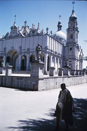
Here is a picture of one of the churches near the hotel in Addis Ababa.
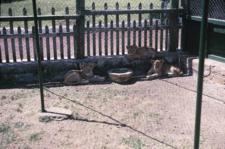
Lion cubs at the zoo in Addis Ababa
Interactive Map of Africa
Check out this interactive map of Africa (it is so cool). Can you find Ethiopia. Do any bodies of water border Ethiopia? Which countries border Ethiopia?
Ethiopian National Anthem
Click to listen to the Ethiopian National Anthem.
equator - an imaginary line on the earth's surface that is positioned halfway between the north pole and the south pole. The equator divides the earth into the northern hemisphere and the southern hemisphere.
natural resources - any substance that is made by nature and used to enhance the lives of living things. Some examples of natural resources include sunlight, minerals, soil, and water.
northern hemisphere - the half of the planet Earth that is north of the equator. The northern hemisphere contains 90% of the human population and most of the land on the Earth.
Northwest Passage - a shortcut between the Atlantic and Pacific Oceans through the Canadian Arctic. This passage is a direct route for ships to travel from Europe to Asia across the Arctic Ocean. The passage is becoming ice-free for the first time since satellite records began to be kept in the 1970s.
peninsula - a piece of land that is bordered by water (on three or more sides), but is not an island. A peninsula is attached to a larger body of land but sticks out into the water.
southern hemisphere - the half of the planet Earth that is south of the equator. The southern hemisphere contains all of Antarctica and Australia, most of South America, and part of Asia and Africa.
Back to topAdditional Web Resources:
Exploring Africa
Exploring Africa brings Africa into your classroom through numerous interdisciplinary lessons. There are 20 modules (within 4 general units of study). The general units include "Why Study Africa," "Studying Africa Through the Social Studies," "Studying Africa Through the Humanities," and "Regional Perspectives." Each module contains a teacher version that includes objectives, focus questions, activities, background information, and more.
The Africa Guide
This website provides a colorful interactive map of Africa. Users are able to click on any country in Africa to learn more about that particular country.
Grade 3-5: Knows the basic elements of maps and globes (title, legend, cardinal, scale, grid, meridians, time zones, etc.).
Grade 3-5: Knows major physical and human features of places as they are represented on maps and globes. Knows how to read different maps: road, relief, globe, etc..
Grade 3-5: Knows the approximate location of major continents, mountain ranges, and bodies of water on Earth.
Grade 6-8: Knows the location of physical and human features on maps and globes (e.g., culture hearths such as Mesopotamia, Huang Ho, the Yucatan Peninsula, the Nile Valley; major ocean currents; wind patterns; land forms; climate regions).
Grade 3-5: Understands how changing transportation and communication technology has affected relationships between locations. Ease of travel between some and difficulty getting to some others because of transportation and how people move and shop from one to the other because of the ease (trains, road systems, ferries, etc...).
Grade 3-5: Knows different methods to measure data (miles, kilometers, time, etc..).
Grade 6-8: Knows the physical characteristics of places (soil, vegetation, wildlife, etc..).
Grade 3-5: Knows the physical components of Earth's atmosphere (weather and climate), lithosphere (land forms such as mountains), hydrosphere (oceans, lakes and rivers), and biosphere (vegetation and biomes).
Grade 3-5: Knows plants and animals associated with various vegetation and climatic region on Earth (i.e. kinds of plants and animals found in the rainforests of Africa).
Grade 3-5: Knows how and why people divide Earth's surface into political and/or economic units (e.g., states in the United States and Mexico; provinces in Canada; countries in North and South America; countries linked in cooperative relationships, such as the European Union).
Grade 6-8: Understands the symbolic importance of capital cities (such as Canberra, a planned city, as the capital of Australia).
Grade 3-5: Knows how communities benefit from the physical environment (e.g., people make their living by farming on fertile land, fishing in local water, working in mines; the community is a port located on a natural harbor, a tourist center located in a scenic or historic area, an industrial center with good access to natural resources).