Teacher Edition | View the Map
Week of December 15, 2024
Right click and SAVE AS
to download the Google Earth file for this episode
Use free Google Earth software
to OPEN it, using File> Open.
Find more tech info here.
The bodyguard was a very large Asian-looking man, but he spoke English. He was obviously not a native of Ethiopia. There was also a teenage boy with the bodyguard. The boy came out to speak to us. He saw our laptop (well, tablet) and was amazed because he had never seen any laptop or tablet. Holy Idaho! Can you imagine never seeing a computer/laptop?
Anyway, we couldn't get online in Abuye, but we still let the teenager take a look at our laptop. He looked at it for a few minutes, then he whispered something to the bodyguard. While he was looking, we took out our photo of Dewey and asked if he had seen the dog. We also told him that we believed that the man and woman who stole the dog were now staying in Abuye. The bodyguard quickly came into our conversation and told us there was no way that they were staying in Abuye. He said that no one could get past him without his knowledge, so he was 100% positive that we were wrong: the Equators were not in Abuye. He told us to leave and never come back.
We tried to reason with him, but he just stood there with his arms crossed. He said nothing. Holy Idaho - how rude!! We were kind of surprised at how he responded to our questions. But we were happy that our driver hadn't left us in this place - because we wanted to get back to our hotel in the capital city of Addis Ababa ASAP! As we were pulling away in our car for our slow (and bumpy) ride home, the bodyguard pulled something out of his pocket (either a phone or walkie-talkie). We could hear him say the words "rid of them". Holy Idaho! "Rid of them" - what does that mean? Something seemed fishy about the bodyguard, but Geo and I went back to the hotel anyway because there was nothing else we could do.
- Meri
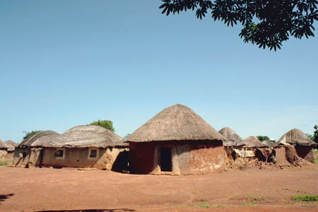
The village of Abuye
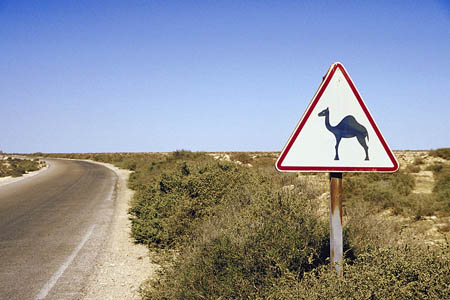
Can you imagine having a camel crossing!
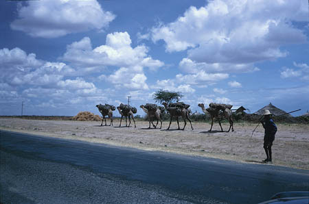
Another cool photo that we took.
Addis Ababa City Tour 2020
Check out this virtual tour (taken by a drone)
Text Message from Uncle GT: C & P heading to S. Africa. U2 need to go to airport ASAP. Tix at gate J-9. HAGD. Pls call when you get to S. Africa.
Thankfully, we received this message before we headed back to Abuye. So now Meri and I are on our way to the airport. Uncle GT sent us a map of South Africa (check it out). He also emailed us some really cool pictures of South Africa. Now we are heading to Cape Town. We will post more when we arrive in South Africa.
- Geo
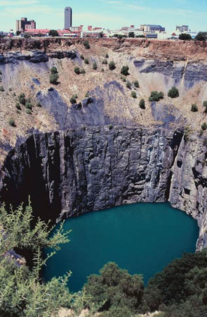
This is the 'Big Hole' - a cliff found in South Africa.
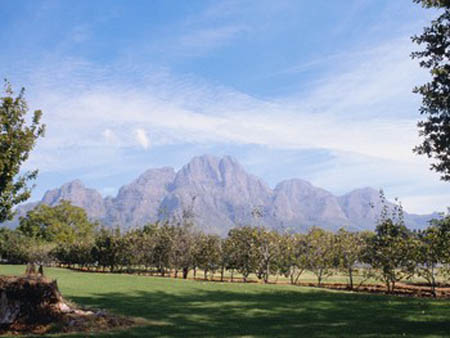
The beautiful landforms of South Africa
South Africa Map
Take a look at the map of South Africa. What cardinal direction would you travel going from Pretoria to Cape Town?
The country of South Africa is rich in natural resources. Holy Idaho! Did you know that South Africa is the world's largest producer of platinum, gold, and chromium? Besides jewelry, I wonder what other products are created using chromium, gold, and platinum? There are also other natural resources found in South Africa: coal, iron ore, manganese, nickel, tin, phosphates, gem diamonds, uranium, copper, salt, natural gas, and more. Holy Idaho! They have a ton of natural resources. I wonder what natural resources are found in North America and South America? South Africa also has a large agricultural base, including wool, beef, vegetables, fruit, sugarcane, corn, wheat, dairy products, and others.
Text Message from Pandora: Where R U? RUOK? Bored :(
Text Message to Pandora: We R OK. In Africa. BBFN.
Poor Pandora, I wish we could tell her more about our adventure. But she is safer, not being involved. Surprisingly, I actually miss my little sister (a little bit).
Today we spent our time visiting various hotels and other tourist locations looking for Dewey. After a frustrating day of investigation (with no leads), we returned to our hotel around 5. There was a voicemail waiting on our hotel telephone. The message said "hotel restaurant - 6 o'clock." We didn't know who left the voicemail, but we figured we'd be safe in a public place. We headed to the restaurant a few minutes before 6:00 to find out more. We were both too nervous to eat anything, so we just ordered sodas. When the waiter brought out our sodas, he handed us our bill in a leather folder. When we opened the folder, we found an envelope addressed to Geo. He opened it, and it said, "You are too late. 20 00 S, 47 00 E." Holy Idaho! Those numbers look like map coordinates for our next stop on our search for Dewey, the truth-sniffing dog. The 20 00 S represents the line of latitude, and the 47 00 E represents the line of longitude. Now we have to go back to our map and see if we can figure out what country Dewey is actually in. Take a look at the attached map and see if you can figure it out. We have it narrowed down to Egypt, Madagascar, or Congo. The country has to be south of the equator since any coordinate that is S (for south) is below the equator. Can you help us? Look for the line of latitude directly under the equator (20 00 S). Which country does that line run through? If you need a review about longitude and latitude, go back and reread our posts from South America. Should we go to Egypt, Madagascar, or Congo?
- Meri
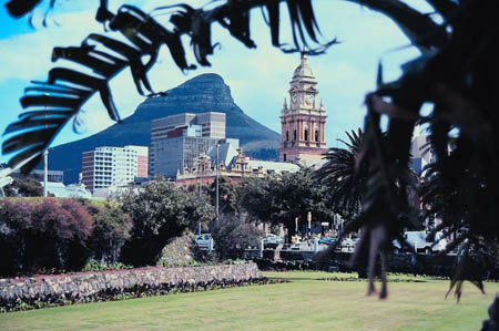
The City of Cape Town (one of the three capitals of South Africa)
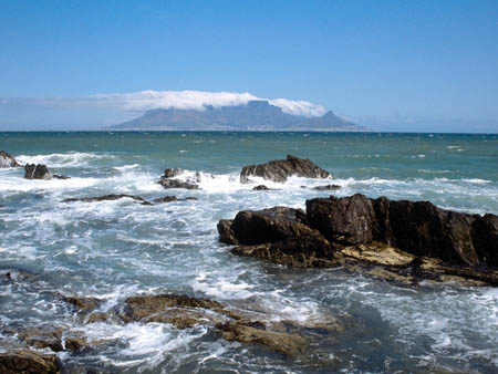
The view of the Atlantic Ocean from Cape Town.
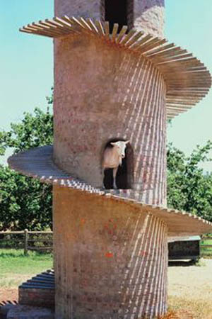
This photo of a goat was too cute not to share :)
Map of Africa
Which country is located at 20 00 S, 47 00 E? Is it Egypt, Madagascar, or Congo? Can you help us?
Airpano
Visit this TOTALLY AWESOME site to see a virtual tour of Cape Town.
Video tour of Table Mountain
Take a virtual tour of this beautiful park.
equator - an imaginary line on the earth's surface that is positioned halfway between the north pole and the south pole. The equator divides the earth into the northern hemisphere and the southern hemisphere.
latitude - the lines that run across (east and west) a map. Lines of latitude measure degrees via north or south. The equator is at 0 degrees latitude.
longitude - lines that run up and down the map (north and south). These lines are used to measure degrees east or west from the prime meridian. The prime meridian is located at 0 degrees longitude.
map coordinates - numbers that provide the exact location of a specified country or other area. The coordinates provide the degrees of longitude and latitude. Coordinates help people locate specific areas on a map.
natural resources - any substance that is made by nature and used to enhance the lives of living things. Some examples of natural resources include sunlight, minerals, soil, and water.
Back to topAdditional Web Resources:
Exploring Africa
Exploring Africa brings Africa into your classroom through numerous interdisciplinary lessons. There are 20 modules (within 4 general units of study). The general units include "Why Study Africa," "Studying Africa Through the Social Studies," "Studying Africa Through the Humanities," and "Regional Perspectives." Each module contains a teacher version that includes objectives, focus questions, activities, background information, and more.
The Africa Guide
This website provides a colorful interactive map of Africa. Users are able to click on any country in Africa to learn more about that particular country.
Grade 3-5: Knows the basic elements of maps and globes (title, legend, cardinal, scale, grid, meridians, time zones, etc.).
Grade 3-5: Uses map grids (e.g., latitude and longitude or alphanumeric system) to plot absolute location.
Grade 3-5: Knows major physical and human features of places as they are represented on maps and globes. Knows how to read different maps: road, relief, globe, etc..
Grade 3-5: Knows the approximate location of major continents, mountain ranges, and bodies of water on Earth.
Grade 6-8: Knows the relative location of, size of, and distances between places.
Grade 3-5: Understands how changing transportation and communication technology has affected relationships between locations. Ease of travel between some and difficulty getting to some others because of transportation and how people move and shop from one to the other because of the ease (trains, road systems, ferries, etc...).
Grade 3-5: Knows different methods to measure data (miles, kilometers, time, etc..).
Grade 6-8: Knows the human characteristics of places (e.g., cultural characteristics such as religion, language, politics, technology, family structure, gender; population characteristics; land uses; levels of development).
Grade 6-8: Knows the physical characteristics of places (soil, vegetation, wildlife, etc..).
Grade 3-5: Knows the characteristics of a variety of regions (climate, housing, religion, language, etc..).
Grade 3-5: Knows plants and animals associated with various vegetation and climatic region on Earth (i.e. kinds of plants and animals found in the rainforests of Africa).
Grade 3-5: Knows the similarities and differences in characteristics of culture in different regions (in terms of food, shelter, social organization and others).
Grade 3-5: Understands how cultures differ in their use of similar environments and resources (for example, comparing how people live in Phoenix, Arizona with how people live is Riyadh, Saudi Arabia).
Grade 6-8: Understands the symbolic importance of capital cities (such as Canberra, a planned city, as the capital of Australia).